Covering over 3.8 million square miles, Canada is the second largest country globally. It is also the biggest nation in North America, spanning six time zones. Looking at the Canadian provinces map is essential to learn more about the country’s geographic distribution. They provide significant insight into this region, like where most of the population lives or which languages are common.
Today, let’s understand this country’s provinces and common boundaries with the United States. Discover which regions have a large French-speaking population with a map of Canadian provinces. Also, learn which places you should check out if you’re visiting Canada.
What Are the Canadian Provinces?
When talking about Canada, you’ll keep hearing about its provinces. As you’re unfamiliar with this term, you’ll wonder what Canadian provinces are. They are regions that get their autonomy from the Constitution Act of 1867. In other words, these regions have their own government, which is in charge of creating laws for the following:
- Civil rights
- Education
- Hospitals
- Municipalities
- Natural resources
- Prison
- Taxes
Rather than the federal government making these decisions, it is the responsibility of the provincial governments. In short, they tend to handle local and private matters exclusive to the provinces.
You can think of them as the local government in the region. Generally, when you think of Canada’s flag, you think of the red and white one with the maple leaf.
Along with the country, these provinces also have separate flags, making them distinct regions. Like the states in the United States, each area also has a capital city. Also, the majority of the Canadian population lives in provinces.
How Many Canadian Provinces Are There?
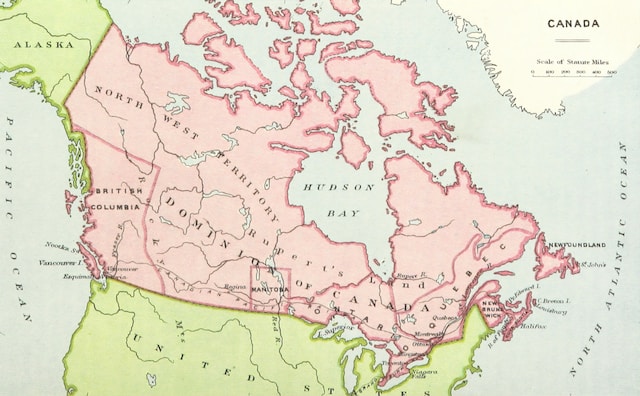
When you start learning about these regions, it’s common to think about how many Canadian provinces there are. Currently, there are 10 Canadian provinces in the country, as highlighted below.
1. Alberta
Alberta is famous because of the mix between its stunning natural landscapes and urban life. The largest North American mountain range runs through this province. Also, it shares a border with the United States.
2. British Columbia
When it comes to the list of most populated regions in Canada, British Columbia comes third. It also has various geographical features, making it a popular destination for adventure seekers.
3. Manitoba
Manitoba’s varying landscapes and wildlife are second to none, offering a unique experience. Longitudinally, it is the country’s center and ranks fifth in total population.
4. New Brunswick
Located along the Atlantic coast, New Brunswick accounts for 0.7% of Canadian soil. The majority of the province is full of forests, while a small portion is for agriculture.
5. Newfoundland and Labrador
Newfoundland and Labrador are the latest regions to join the Canadian province. It became the 10th province after people voted for the region’s future in 1948. Like several other provinces, people know Newfoundland for its incredible hikes.
6. Nova Scotia
Nova Scotia is also along the Atlantic coast, making it a hotspot for water-related adventure activities. Unlike other larger provinces, this region only covers 0.6% of Canada. This province has the largest Canadian Forces Base (CFB), accounting for over 40% of the country’s military assets. Cape Breton Island is a popular tourist destination in Nova Scotia.
7. Ontario
Canada’s capital, Ottawa, is in the Ontario province. It is the most populated region, accounting for 10.8% of the country’s total area. The southern section focuses on agriculture and manufacturing, while the northern part relies on forestry and mining.
8. Prince Edward Island
The smallest province in Canada belongs to Prince Edward Island. It has a large number of North Atlantic right whales, a rare species. Agriculture, fishery, and tourism are their primary sources of generating revenue.
9. Quebec
Quebec is the largest compared to other provinces, with over 8 million people in this region. It is culturally rich and has a diverse population. This region offers the right blend of countryside and urban landscapes.
10. Saskatchewan
Freshwater sources like lakes, rivers, and reservoirs occupy close to 10% of the total area in Saskatchewan. The province relies on industries in agriculture, energy, and mining. Prairies and the boreal forest are in the south and north of this region.
Which Canadian Provinces Speak French?
Due to Canada’s history with Europe, it has a vibrant French community. Did you know that nearly a quarter of the population’s mother tongue is French? The country’s relationship with France goes back to the 16th century.
Given the European influence, which Canadian provinces speak French? There are three provinces where anyone who speaks French will feel at home:
- Quebec
Quebec and French are synonymous with one another as French is the official language of this province. You’ll find signs in French as you pass through this region. The majority of the people who live here can speak this language fluently.
You can see the French influence in this region’s history and heritage. Although provinces are autonomous, this area has different civil laws. The French heritage civil law comes into play when dealing with civil matters. However, other aspects of the law, like federal, criminal, and public law, follow the Canadian common law. - Ontario
About 4.7% of the population in this region are native French speakers. Although the province doesn’t claim French as its primary language, the government uses it extensively. Bills and provincial statutes have to be in this language, along with English. People can communicate with any government department’s central office in French. - New Brunswick
Out of all the provinces, only this region falls under the official bilingual category. One-third of the population can speak French as their primary language. Several members of the Acadian community reside in this province. They are the descendants of French settlers who visited Canada in the 17th – 18th century.
Which Canadian Provinces Border Alaska?
Given the country’s proximity and large shared border with the United States, you might wonder which Canadian provinces border Alaska. It is the United States’ northernmost state in the region and has a total area of over 660,000 square miles. This is visible in the Canadian map with provinces and territories.
On the Eastern side of the state, it shares a border with Canada. This region is Yukon, which is a territory, not a state. White Pass and Yukon Route Railway connect the two along with the Klondike Highway.
Alaska also shares a much smaller border with British Columbia, a Canadian province. The closest town in British Columbia to Alaska is Stewart. The total population in this region is under 500.
Just south of the town is Hyder, another small town where only 48 people live.
You’ll barely find people here because of the remote regions along the border. Also, the border between the two countries is the largest, covering over 5,500 miles.
3 Places To Visit When Going to Canada
When you visit Canada, it often feels like you can spend several lifetimes exploring the country. It offers incredible natural views while ensuring access to all your creature comforts. Below is a list of three places you must visit when you go to Canada:
- Jasper National Park
Jasper National Park is a must-visit if you’re all about the outdoor lifestyle. For starters, the trail network is incredible, offering a variety of ways to reconnect with nature. It is also the place to be if you want a clear look at the night sky. The national park is far away from any artificial light source.
Pack your camping and camera gear before you head to locations like Old Fort Point, Pyramid Island, and Maligne Lake. - Niagara Falls
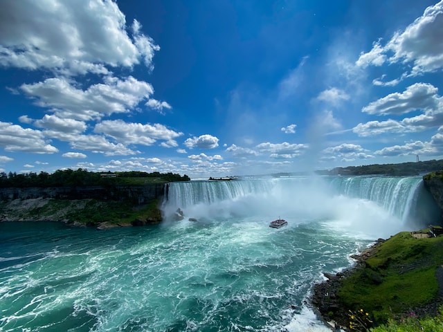
Niagara Falls in Canada gives you an incredible view of the roaring waterfalls. If you’re feeling adventurous, try the Journey Behind the Falls. You go down 125 feet into a tunnel network that allows you to experience the waterfalls in all its glory. There’s an observation deck that will enable you to get close to this iconic destination.
The other option to go near the waterfall is to take a boat or helicopter tour. If you like hiking, check out the Niagara Glen Nature Center. - Whitehorse
If the Northern Lights is on your list, Whitehorse is a great destination to see this phenomenon. You only have to leave the city for nature’s light show to start. The best season to view it is at the start of winter.
You can also check out the Eclipse Nordic Hot Springs to watch the night sky explode with color. This way, you won’t have to worry about the cold.
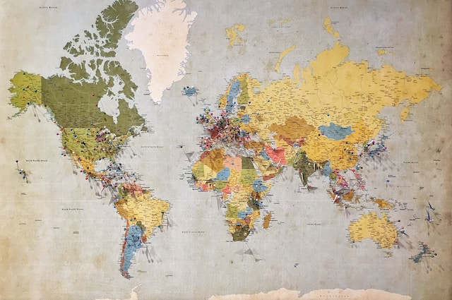
With a map of Canadian provinces and territories, finding these locations and planning a trip is easy.
Make a Customized Canadian Provinces Map for Your Vacation With Mapize
A custom map for your vacation can help save time, as you already know all the places to visit. Although Google Maps is handy, it has a lot of limitations. For instance, you can’t add more than ten stops, which isn’t enough if you’re going on a road trip. Also, it doesn’t always pick the best routes, which means you may end up taking a longer time than expected.
Mapize has a direction optimizer feature to ensure you always find the fastest route to your destination. You can add multiple stops according to your itinerary. If you want to make last-minute changes (as with any travel plan), it is effortless on Mapize. You’ll know the distance between each location you want to visit and the time it takes to reach the destination.
This custom online map builder uses Google Maps as its foundation and offers additional features to improve its functionality.
What if you’re collaborating with multiple people for the travel itinerary? You can list all the places and their addresses on a spreadsheet and upload it to Mapize. The mapping software will take it from there and plot everything on a map. After you create it, you can share it with your travel buddies so everyone is on the same page.
What if you’re visiting a remote place in Canada with poor network? Don’t worry; you can save the map or download it offline.
Be in the moment and enjoy your trip while the mapping software finds you the best routes. Not only will you save time, but also money. Canada has much to offer, and with Mapize, you can plan your vacation easily.
Become a Mapize member for free today to create your first customized Canadian provinces map for your vacation!
