As part of daily living, we commute from one location to another. We try to find the fastest route to our workplace, plan a road trip, or for a business delivery service. These commutes often require reaching multiple stops before arriving at the final destination. Thus, our daily navigation makes knowing how to map multiple locations an essential skill to learn.
Mapping multiple locations in today’s interconnected world can save precious time and resources. Suppose you are an enthusiastic traveler trying to reach multiple locations in one trip. Or, you are in the delivery business and looking for the perfect delivery route for your customers. Not to worry, in this guide, we’ll provide you with easy steps to map multiple locations effectively.

- 3 Reasons Why You Should Learn How To Map Multi-Stops
- Simple Steps to Map Online Like a Pro
- What Is the Best Way to Map Multiple Locations? 3 Methods You Should Know
- How to Map Multiple Locations for Best Route
- How to Map Multiple Locations at Once
- How to Map Multiple Locations From Excel in 5 Easy Steps
- Create a Map With Multiple Locations With Top-Tier Mapping Platforms
- Plot Multiple Locations on a Map With Mapize
3 Reasons Why You Should Learn How To Map Multi-Stops
Learning how to map multiple locations is a must-have skill to unlock vital opportunities. Apart from finding the best routes for your navigation, this skill can help enhance your decision-making and optimize your trips. Let’s quickly consider three reasons why mapping multiple locations is a worthy endeavor to undertake.
1. Knowing How to Map Multiple Locations Enhances Efficient Travel and Route Optimization
Different situations and circumstances require you to up your skills in mapping multiple locations. You may be planning a vacation, organizing a business trip, or coordinating a delivery operation in your business. Knowing how to map multiple locations in these situations can help provide efficient travel and route optimization.
You don’t need to rely on trial and error. Instead, you can leverage mapping tools to calculate travel time and the best route for navigation. Ultimately, this saves you time and costs.

2. Learning How to Map Multiple Locations Unveils Geographic Patterns and Insights
Since its early developments, maps have provided a path to discovering patterns and hidden gems about our world. By learning how to map multiple locations, you can visually represent data in a spatial context. This reveals patterns and trends that you may not otherwise notice.
You can identify clusters, hotspots, and areas of interest. Interestingly, businesses map multiple locations to gain invaluable insights that drive positive change in their organization.
3. Learning How to Map Multiple Locations Promotes Data Visualization and Communication
The modern world we live in is data-driven. Thus, there is a need to communicate information effectively. When you learn how to map multiple locations, you can transform complex datasets into compelling, easily understandable visualizations.
Maps are excellent data visualization tools that transcend language barriers and culture. Through maps, you convey information in the best way possible through appealing visual graphics. Additionally, with mapping tools, you can customize maps to make them more interactive and captive your audience.

Simple Steps to Map Online Like a Pro
Knowing how to map multiple locations is vital in our daily navigation, as it has personal and corporate advantages. As an individual or a business organization, it is necessary to know how to map various locations effortlessly. Doing so personally allows you to gain valuable information when optimizing your present and future trips. Without further ado, here is what you need to do to map multiple locations like a pro:
- Choose a Proper Mapping Platform: This is vital—selecting the right platform helps solve your mapping needs. Despite numerous offerings, many users flock to Google Maps, Maptive, and Mapize. Ensure to research these platforms to know which one works for you.
- Gather Your Location Data: Next, you must have the geographic coordinates and addresses of the locations you want to map. You can have them in a spreadsheet format like Excel, where you can analyze them for duplicity or errors.
- Import Your Location List to Your Mapping Platform: The above mapping platforms can help import multiple locations and have them on a custom map.
- Customize Your Map: After importing, you can customize your maps to make them more interactive for your users. You can incorporate visual elements like markers, zoom, and pan features for others to gain valuable information.

What Is the Best Way to Map Multiple Locations? 3 Methods You Should Know
While learning how to map multiple locations is a must-have skill, it requires a systematic approach to ensure accurate results. Therefore, it is important to consider the best way to map multiple locations:
- Use of Geographic Information System (GIS)
GIS software such as ArcGIS, QGIS, and Google Earth Pro offers powerful tools. These platforms allow you to import location data, customize map styles and perform spatial analysis. GIS is practically useful in unraveling complex mapping projects involving extensive geographic data and advanced geospatial trends. - Use Online Mapping Platforms
User-friendly platforms like Google Maps, Map Quest, and Bing Maps provide an accessible way of mapping multiple locations. These platforms offer multi-route planning and optimization, current traffic updates, and customizable markers. Interestingly, they are suitable for small to medium-scale mapping tasks and are integral in navigation. - Programming and API
For advanced data scientists and developers, programming languages and APIs are suitable ways to customize mapping locations. Programming languages like JavaScript and Python enable customized mapping applications and offer flexibility in data visualization. Whichever method you employ in mapping your intended multiple locations, ensure it aligns with your mapping needs and required expertise.

How to Map Multiple Locations for Best Route
Finding the best route between locations is vital. Mapping multiple locations for the best route is crucial for optimizing travel plans and delivery routes.
You can minimize travel time, fuel, and resources by considering distance, current traffic conditions, and time constraints. Here are some approaches on how to map multiple locations for the best route:
- Gather Location data: Collect the addresses or geographic coordinates (latitude and longitude) of the locations you want to visit. It is important to verify the accuracy of each location’s data and ensure it is complete.
- Employ a Routing Tool: Based on your mapping needs, consider choosing one of these popular options:
- Dedicated Routing Software: Specialized routing software like OptaPlanner and Route4Me offers advanced route optimization features. These tools allow you to automatically import location data, define constraints, and generate optimized routes.
- Online Route Planning Platforms: Popular navigation apps like Google Maps and Waze provide built-in route optimization features. These platforms calculate the most efficient route based on real-time traffic data by inputting multiple destinations.
- Input Multiple Locations: Whichever routing tool you employ, enter the addresses or coordinates of your multiple locations.
- Generate the Optimal Route: After inputting all locations’ addresses into your routing tool, let it calculate the best route based on the provided data.
- Review and Adjust Your Route: Review the generated route and make any necessary adjustments. You may need to adjust the order according to a specific requirement or real-time conditions for a multi-stop route.
When you finish, you can use a GPS device to guide you along the generated route. It is essential to note that real-life scenarios can impact the time it takes to complete your route. Hence, monitor your route in real-time and make necessary adjustments if needed.

How to Map Multiple Locations at Once
As we highlight the benefits of mapping multiple locations, there is an advantage of mapping them only once. This process is another valuable tool that saves time while unlocking a wealth of information and insights.
Mapping multiple locations simultaneously is particularly useful when dealing with a large dataset or visualizing various points. The following methods can help you learn how to map multiple locations at once efficiently:
- Batch Geocoding
Geocoding is the process of converting addresses into geographic coordinates. Batch geocoding allows you to geocode multiple addresses in a single operation. Services like Google Geocoding API, MapQuest Geocoding API, and OpenCage Geocoder offer batch geocoding capabilities.
Provide a list of addresses to the geocoding service, giving you the corresponding latitude and longitude coordinates. Once you have the coordinates, you can map multiple locations and visualize them on a map. - Heatmaps
Heatmaps visually represent data density or geographic intensity on a map. You can identify areas with high or low concentration by mapping multiple locations and applying a heatmap overlay.
They help understand data distribution and trend identification. Tools like Google Maps, Power Bi, and Tableau offer heatmap functionality. These tools allow you to analyze and visualize heat maps at a glance. - Geographic Data Visualization Software
Platforms like Tableau, Power BI, and Google Studio provide robust data visualization capabilities. These visualization tools enable you to import and map large datasets. They also customize visual elements and apply filters to analyze multiple locations simultaneously.
How to Map Multiple Locations From Excel in 5 Easy Steps
Excel is a ubiquitous tool for organizing and analyzing vast amounts of information. You can learn how to map multiple locations from Excel if you have a spreadsheet containing numerous addresses or map points. Doing so lets you map your preferred locations while unlocking valuable spatial insights.
If you’re wondering how, it is straightforward and requires little coding knowledge. Here are the steps below:
- Prepare your Excel data by arranging all location information properly. This includes creating columns containing addresses or other essential geographic data.
- Geocode your data by converting addresses into geographic coordinates. Several Excel geocoding tools and ad-ins, such as GeocodeFactory and GeocodeXL, are available.
- Select a mapping platform that suits the needs of your spreadsheets. There are popular options, such as Google Maps, Mapize, MapQuest, and ArcGIS. These platforms allow you to import data from Excel and offer further customizations.
- After selecting a mapping platform, import your geocoded data into it. You can further customize your maps based on your preference by adding markers, labels, and other visual elements.
- Run a spatial analysis of your mapped multiple locations. Explore the map to identify patterns, clusters, or other spatial relationships.
Create a Map With Multiple Locations With Top-Tier Mapping Platforms
Undoubtedly, you have uncovered gems on how to map multiple locations for your individual or professional needs. Learning to create a map with various locations is vital in a world of complex data. However, successfully creating this map requires utilizing top-tier platforms.
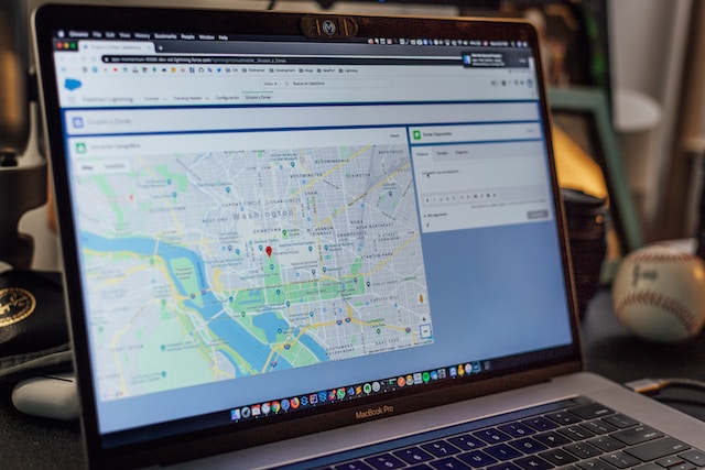
One platform that has gained popularity amongst its contemporary is Google Maps. This platform introduces a feature, My Maps, a custom maps platform for your mapping needs. Access to this allows you to create a map and add as many locations as you want. You can also generate routes linking your multiple locations and get driving directions to reach them.
Another platform is Mapize. Mapize is an AI-powered platform that can help you create a map with multiple locations without breaking a sweat. By leveraging Google Maps’ geocoding API, it automatically converts addresses of places into geographic coordinates. Then, it plots them onto a map for further customization and analysis.
You only need a spreadsheet containing the locations you want to map. You can import them or use the drag-and-drop method to the platform. You can also add customizations to make your map more visually appealing and interactive. You’re ready to go with just a click on the “Create a New Map” button.
Plot Multiple Locations on a Map With Mapize
Learning how to map multiple locations is key to unlocking a world of endless possibilities and efficient navigation. Whether you’re planning a road trip, optimizing delivery routes, or analyzing geographic data, Mapize provides an exhilarating solution.
Mapize offers a user-friendly solution that can help you easily plot multiple locations. This platform provides customization options, allowing you to focus on specific areas of interest and simplify connections between points. Mapize’s in-proximity store locator also narrows search results based on addresses entered.
The free version allows mapping up to 250 locations, with advanced features available at affordable rates. Mapize uses Google API and an intelligent algorithm with an intuitive interface, making it easy for users to plot multiple locations without coding knowledge. With Mapize, mapping numerous locations becomes an efficient and enjoyable task. So, why wait? Join Mapize today and create your first custom map.
