Digital mapping has transformed how we explore and navigate the world. It involves using technology to develop, analyze, and show geographic data, resulting in interactive and dynamic maps available on many devices. Click distance is an integral component of digital mapping since it influences the user’s ability to interact with and manipulate the map interface.
Understanding and optimizing it is critical for developers and designers who want to create user-friendly interfaces that convey spatial information efficiently. In this article, we’ll learn what a click distance is, how to calculate and optimize it, and its benefits.
- What Is a Click Distance and Its Role in User Interaction?
- What Is a Klick in Military Distance?
- How To Calculate Click Distance for Efficient Route Planning
- How To Measure Distance on Google Maps
- 6 Ways To Optimize Click Distance to Enhance Mapping Interactions
- 5 Benefits of Optimizing Click Distance
- Optimize Click Distance With Mapize
What Is a Click Distance and Its Role in User Interaction?
You might be wondering, “What is a click distance and its role in user interaction?” A click distance is the distance a user’s input device (e.g., mouse) must travel across the digital map interface to interact with map elements.
People also refer to it as “Klick distance.” It plays an important role in user interaction because it helps to promote user interactions and the exploration of spatial information. This distance determines the precision and ease with which users navigate, zoom, and select points of interest on a digital map. It directly impacts the accuracy, efficiency, and overall user experience while working with mapping programs.
A small klick distance suggests that users make few cursor movements to select or interact with map components in mapping. This means the user makes minimal movement to make clear choices, such as pinning a certain location on a map. A wider klick distance, on the other hand, lessens the sensitivity of cursor movements. As such, it makes it easier to choose significant map components and lowers the chance of random selections.
Optimizing klick distance entails striking the correct balance between precision and usability. Developers and designers can construct user-friendly programs that enable intuitive and practical exploration of geographic information by considering it in mapping interfaces. Using the proper klick distance ensures you can interact with the map efficiently, understand the feature, and browse the map interface easily. However, it is important to recognize that “klick” has a different meaning in the military context.
What Is a Klick in Military Distance?
You may have heard the word “klick/click” before if you’ve seen a military movie or played a military-themed game. But the question is, “What is a klick in military distance?” A “klick” is a slang term for a kilometer, a unit of measurement equal to 1,000 meters or approximately 0.62 miles. Military personnel regularly utilize it to communicate and calculate distances during strategic operations, training exercises, and mission planning.
While the exact origins of “klick” is unknown, some historians believe the Australian military in Vietnam coined it. Foot soldiers would use a compass to follow directions and pace to calculate click distances. Each soldier counted their steps, and 110 paces on flat ground, 120 paces uphill, and 100 paces downhill equaled 100 meters.
At the time, they regarded every 100 meters as a “mark.” When soldiers completed a mark, they would signal their commander and show a 1,000-meter movement. They often do this by hoisting up their rifle and moving the gas regulator with their thumb, creating a “click” that the commander could hear. The term klick originated with this sound.
The term “klick” also frequently appears in works of literature, films, or conversations with people who have served in the military. Overall, a “klick” in military distance measurement is a practical and easily understood slang for a kilometer. It enables efficient and effective communication of distances in military operations and conversations. Both “klick distance” and “click distance” refers to the physical or virtual distance a person covers to reach a point. As such, you can use the words interchangeably.
How To Calculate Click Distance for Efficient Route Planning
Calculating click distance enables precise measurements and effective route planning by identifying the shortest or most efficient path between two points. Here’s a step-by-step guide on how to calculate it:
- Determine the Scale
Examine the map scale, which shows the link between map distance and real-world distance. It often appears as a ratio (for example, 1:40,000). This implies that one unit on the map corresponds to 40,000 units on the ground.
- Measure the Distance
Using a ruler, measure the distance between the two spots you want to calculate on the map. Use the same unit of measurement as the scale of the map.
- Convert to Ground Distance
To calculate the ground distance between two spots, multiply the measured distance on the map by the scale ratio. For example, if the measured distance on a map with a scale of 1:40,000 is 5 centimeters, the ground distance is 5 cm x 40,000 = 200,000 cm, or 2 kilometers.
- Determine the Click Distance
Divide the ground distance by the specified click measurement to determine clicks. For example, if one click equals one kilometer, the distance in the preceding example would be 2 kilometers / 1 kilometer = 2 clicks.
- Consider Adjustments
There may be changes in the context or purpose. In military operations, for example, variances in topography or tactical factors may necessitate adjustments to the calculated klick distance.
Note that these computations on maps only provide general estimates rather than accurate estimates. They rely on the map’s scale, which may not account for topographical irregularities or other variables. Hence, endeavor to use mapping tools like Google Maps or Mapize to analyze location data trends for more accurate measurements.
How To Measure Distance on Google Maps
Google Maps provides measurement in real-world distances, such as kilometers and meters. It measures click distance which shows the distance between two points you select on the map.
Using Your Phone To Measure Distance on Google Maps
Here’s how to measure distance on Google Maps on your phone:
Step 1: Open the Google Maps app on your phone.
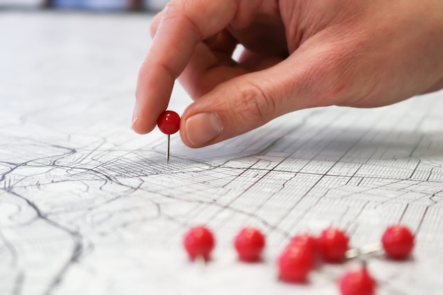
Step 2: Zoom in on the map. Then, select and hold anywhere on the map without a location name or icon. A red pin will automatically appear.
Step 3: Swipe your screen to the left from the bottom. A list of options will pop up.
Step 4: Choose “Measure Distance.”
Step 5: Drag your finger to the point where you wish to measure the klick distance while still holding it on the screen. As you drag, you’ll see a measurement line between the starting and ending points.
Step 6: Remove your finger from the screen once you reach your destination. Google Maps will display the measurement representing the klick distance between the two points.
Using a PC To Measure Distance on Google Maps
Here’s how to measure distance on Google Maps on a PC:
Step 1: Open your web browser and visit the Google Maps website.
Step 2: Enter your destination or address in the search field and click “Enter.” The map will zoom in on the location you specify.
Step 3: Right-click on the map’s beginning point where you want to estimate the distance. Select “Measure Distance” from the context menu that opens.
Step 4: Set waypoints along the route you want to measure by clicking on the map. Each click adds a new waypoint. You can click more than once to get a more precise measurement.
Step 5: After setting waypoints and getting the click distance measurement, you can exit the distance measurement mode.
6 Ways To Optimize Click Distance to Enhance Mapping Interactions
Optimizing klick distance means minimizing the number of clicks a user needs to perform a task or navigate within a mapping interface. It aims to improve efficiency and user experience by decreasing the cursor or pointer movement. Here are six ways to optimize click distance to enhance mapping interactions:
- Strategic Object Placement
Carefully consider where you want to place objects and points of interest on the map. Avoid grouping or overlapping objects to reduce the possibility of unintentional clicks or the necessity for precision clicking. Distribute map elements evenly to lessen klick distance.
- Organize Your Map
Ensure you hierarchically organize the map interface by positioning key and mostly-used components closer to the user’s starting point. This decreases the need for many navigations and shortens the distance between clicks.
- Zoom Detail and Level
Provide default zoom levels that allow users to adjust the detail level. By providing enough information and avoiding clutter, users interact with the map more efficiently without zooming excessively.
- Labeling and Call Out
Use good labeling and callouts to convey helpful information without altering the map view. This eliminates the need for users to click on items to get basic information, hence reducing click distance.
- Contextual Interaction
Include cues and actions based on the user’s location or previous actions. Provide relevant alternatives or shortcuts that avoid the need for excess navigation or screen switching.
- Shortcuts and Gestures
Use gestures or keyboard shortcuts to help users execute tasks more quickly. Allowing users to conduct activities by double-clicking or using specified vital combinations lowers the physical distance traversed by the cursor or pointer.
5 Benefits of Optimizing Click Distance
Businesses, cartographers, and government agencies create maps to assist them with planning, navigation, analysis, and decision-making. Optimizing is critical for optimum mapping interactions and user experience. Here are the five benefits of optimizing click distance.
- Greater Efficiency and Productivity
Optimization improves efficiency and productivity by streamlining the process of obtaining information and locating points of interest on the map. It saves consumers time and effort, allowing them to execute activities more efficiently. Businesses and government bodies benefit from increased productivity due to this efficiency.
- Better Decision-Making
Government, businesses, and geospatial analysts use maps for data analysis and decision-making. They can get essential information more quickly and efficiently by optimizing klick distance. This facilitates the identification of patterns, comprehending spatial relationships, and making decisions in urban planning, disaster management, and resource allocation.
- Effective Communication
Businesses and government agencies use maps to communicate information to their audiences. Klick distance optimization allows businesses to map multiple locations and share them with just a click. They can also develop user-friendly maps that effectively transmit messages and enable clear spatial communication.
- Increased Field Operations Efficiency
Optimized klick distance benefits field staff and geospatial analysts who rely on mobile mapping tools. They can carry out field activities more efficiently with fewer clicks and easier access to information. Such responsibilities include asset management, field surveys, emergency response, and utility maintenance.
- Geospatial Analysis and Insights
Geospatial analysts can extract more insights and patterns by optimizing click distance. This results in more informed judgments. Thus, they can focus more on data exploration and analysis, allowing for deeper comprehension and interpretation of spatial data.
Optimize Click Distance With Mapize
Mapize is a fantastic online mapping tool with an easy-to-use design, exact location search, and quick navigation. Thanks to its smart features and smooth functionality, it provides a seamless mapping experience for users, making it a top choice for all your mapping needs. Mapize helps businesses and developers create proficient maps while optimizing click distance. Built on a robust API, Mapize provides accurate clues based on users’ previous activities, decreasing searching time. Its user-friendly interface simplifies navigation and reduces clicks for a smoother experience. Join Mapize today and discover the true freedom of optimizing click distance and creating unique maps.
